Interfaces de lo Invisible
Artistic research project and exhibition
Querétaro, México
2022 - 2023
Interfaces de lo Invisible aims to work with the inconmensurability of environmental processes and their planetary scales by utilizing physical interfaces that create affective ways of relating to the environment an big data sets.
The different relationships between sedimentation, erosion, water cycles, and the environment become apparent by superimposing the atmosphere – represented by a suspended six meter aeolian harp that acts as a signaling device for the passing of wind – and the lithosphere made visible using a georadar to produce a geophysical section of a walk throughout Querétaro’s historic downtown.

We understand that this gap is caused, on the one hand, by the immeasurable nature of the multiplicity of scales involved and connected, and on the other, by the way in which technologies and data are visualized and communicated. Therefore, this research seeks to begin to understand and recognize this climate emergency through affective relationships supported by contemporary art methodologies and emerging and accessible technologies.
Section


The exhibition is conceptualized through a geophysical section. Thinking in section is a relatively difficult task, almost impossible since the conventions used to build a section are never adequate or faithful to what they want to represent by definition. A section is a construction of the interpretation of a space seen from a plane which we will never be able to observe. In this case, this plane is built by different mechanisms and technologies, from which the different pieces or workshops of this exhibition are obtained.
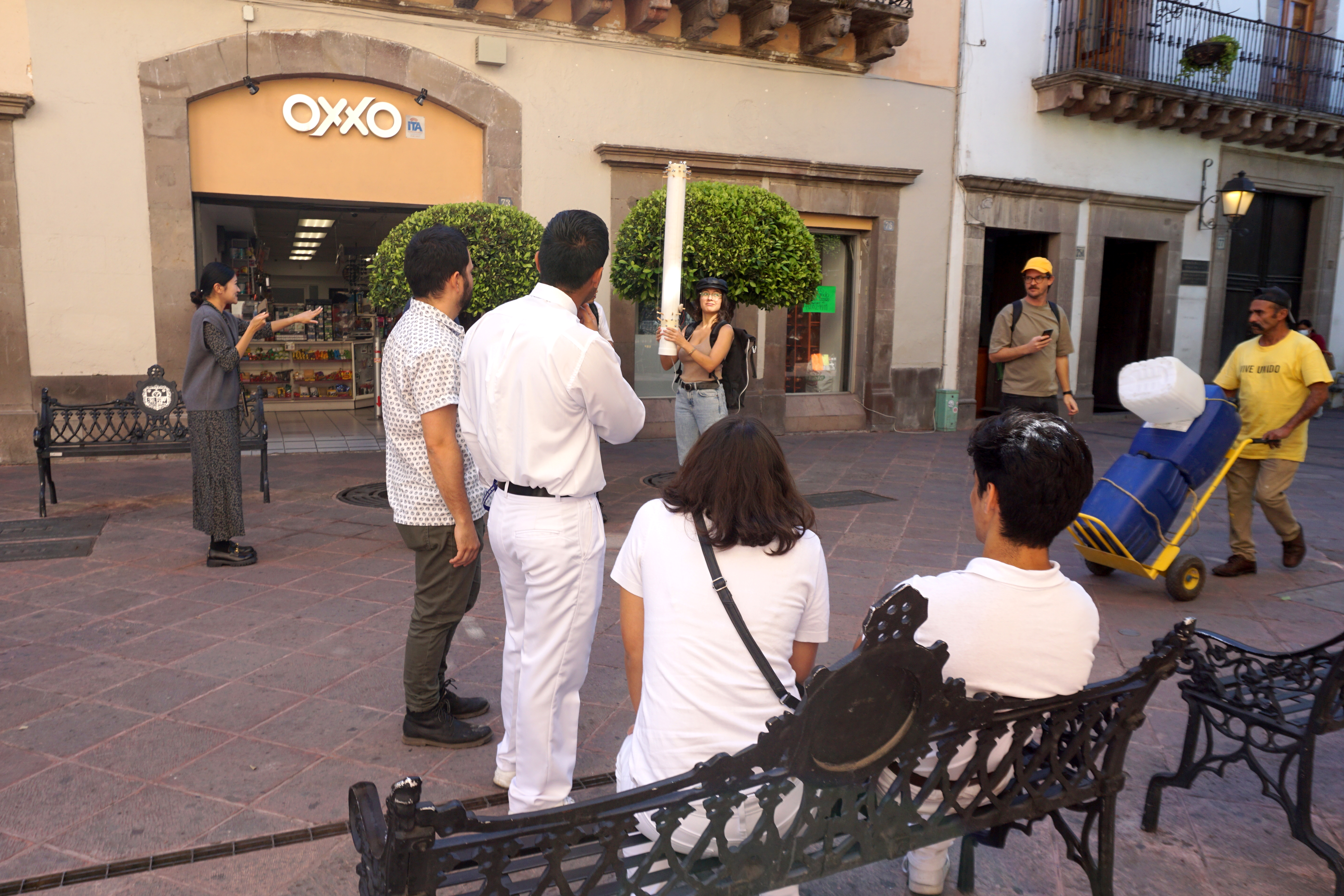
Walking, public life and measurement
What is the correct speed to measure or detect the planetary?
We propose a maximum of 5 km/h
Because
walking is accessible
walking is free
walking is chaotic
walking is slow
Walking provides a sense of scale.
Walking works well with space/time problems.
Walking occupies and changes the space
Walking is a shared activity
walking is thinking
walking is understanding
Walking can never be done in a straight line.
Walking while sleeping.
walk with animals
walking as research
Walking alters common sense
To walk
Subsoil
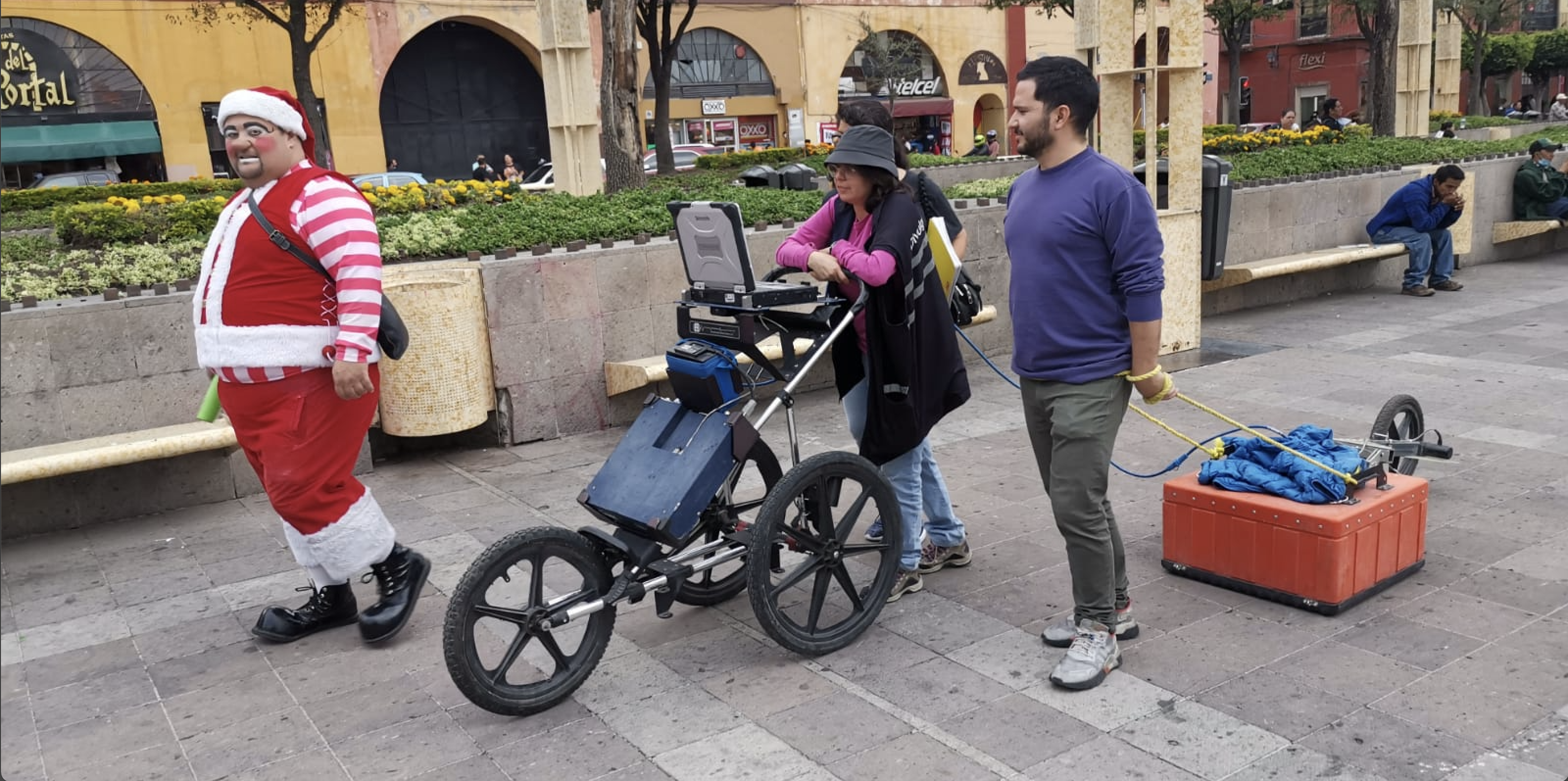
The subsoil and everything it hides becomes apparent through the use of a georadar and the displacement of its series of antennas that emit and receive signals that build a map formulated in space and time by means of electromagnetic signals; a radargram. Walking with said interface and observing the section being built on the screen while
moving forward manages to create a human-machine-environment relationship that dislocates the walker’s sense of scale. Said technology is used to find underground objects lodged in the subsoil of both geological and anthropogenic origin and lately to find bodies of missing people in mass graves – which says a lot about our current condition.The radargram that surrounds the room is made up of fragments of the readings obtained in the historic center of Querétaro. On these walls is part of the representation of the electromagnetic traces in a section 3 meters deep, making apparent the sedimentation that has taken place over time. Streets that were a ditch, part of the main road inland, an old Franciscan orchard, or an underground parking lot. It is important to note that the images are a representation of the contrasts in the dielectric properties of the medium, in which the greater magnitudes in the contrasts due to the presence of materials other than the subsoil itself are highlighted by means of black or white stripes. . The real value of these images is given by interpreting the anomalies found, trying to make visible what is causing the contrast. The interpretation of the radargrams is refined by compiling information on the historical context of land use, architecture, and infrastructure of the streets along which the readings were made.
Sedimentation
Just as the geological strata join together and become part of the subsoil, the ideas and ways of thinking about our life and relationship with our environment become sedimentary. This is, then, an invitation to make these layers apparent both in the geological and environmental aspects and in the ordinary of our existence; to re-cognize how to organize the world.
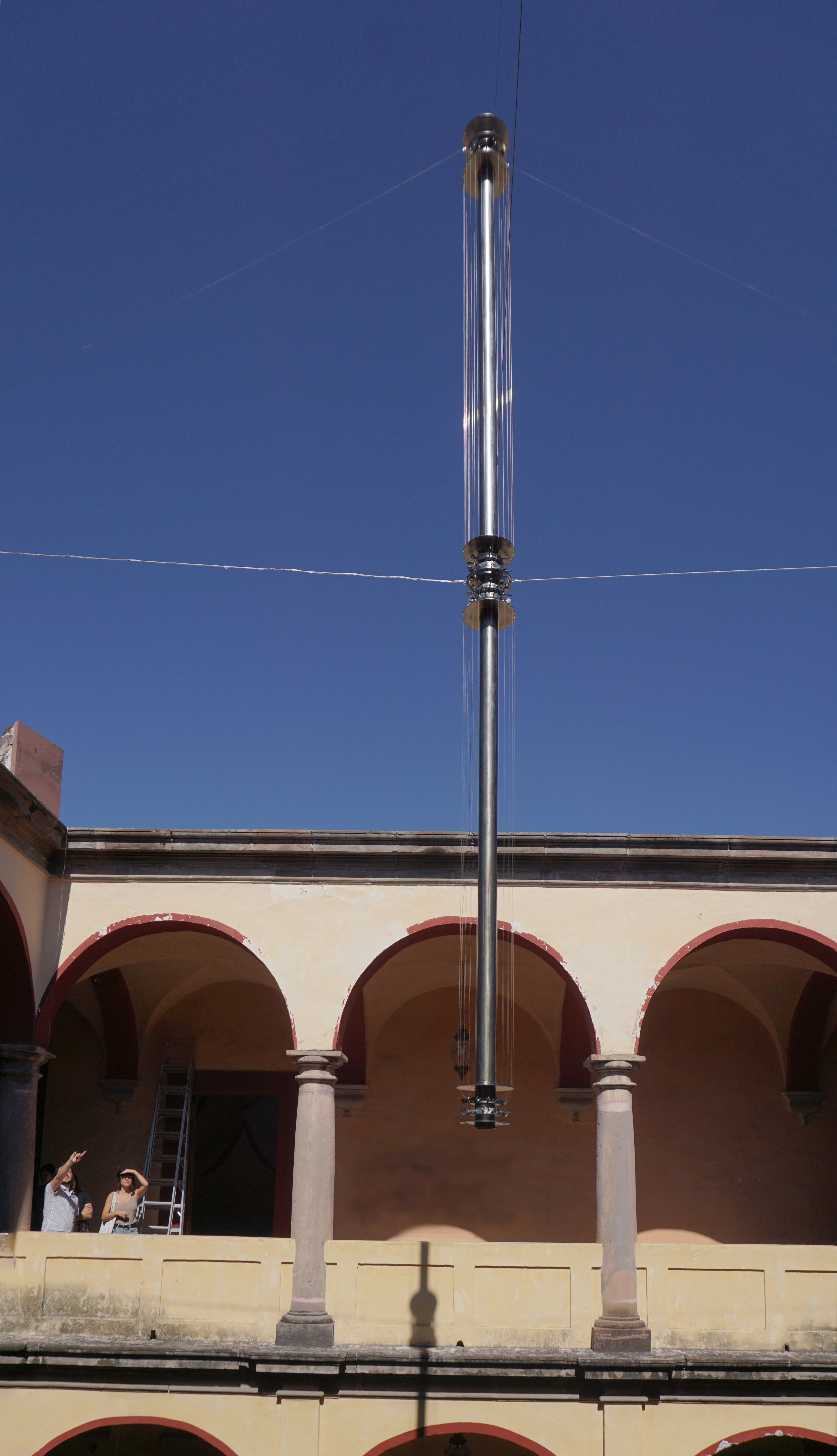
Atmosphere
The other invisible layer is in the upper part of our section. The atmosphere, understood as a fluid, governs human, non-human and more than human lives in an absolute way. We feel the air, the rain, the heavy particles from the thousands of cars in the city; eyes watery, throat dry, head aches, animals come and go when it rains. The city gets flooded and has no drinking water at the same time. We are touched and touched by the same environmental phenomena that run throughout the continent and we witness their increasingly unfamiliar behaviors. So, is it possible to navigate the city thinking about the atmosphere?
There is no sound without atmosphere
What analog technologies exist to make their behaviors present and what would then be the role of sound in the multi-scale understanding of the planet?
The piece suspended in the courtyard acts as an instrument and interface with the atmosphere. Through the continuous movement of the wind, the strings of the piece generate vibrations that make the hollow tubular resonate, causing it to translate these vibrations into sound each time the wind travels. The piece is active and is dependent on the behavior of the atmosphere. This atmospheric instrument is connected to an FM transmitter whose waves travel to a receiver that amplifies the readings in the room, activating the pulsations of both radargrams, causing a moiré effect. This overlap between spectrogram and radargram speaks of the relationship between the geological layers and the atmosphere, which are closely related. By superimposing the atmosphere and lithosphere in this way, the different relationships between sedimentation, erosion, water cycles and the environment become apparent.
This exhibition is possible thanks to the support of the Support System for Creation and Cultural Projects (SACPC), the Querétaro City Museum, the UNAM Geosciences Center, BEMA, Zonesound Creative and Dérive Lab.